I parked just off US 340, walked under the railroad bridge,
 |
| Start of Tuscarora Trail off US 340 |
and promptly lost the trail. It goes right immediately after the stone pillared gate. Instead, I sauntered up the road to a major deforestation project. It surprised me that all the logging was taking place after I passed the following sign:

Backtracking, I crossed over a newly gravelled culvert (not the trail as it turns out) and by chance stumbled upon the trail. Apparently very few people use this trail (and with good reason ... it's boring). It goes up and down hills for 3 miles until it joins the Overall Run trail. One thing I noticed right away was the flies. Common house flies were everywhere. Then I saw the butterflies: tiger swallow tails, black swallow tails, little blue butterflies, little brown and grey ones, and a pretty almost white butterfly with a pink/red stripe. Especially near the seeps there were lots of butterflies. So far no biting insects but I fully expect them in the near future, especially after it rains.
Overall Run is a great stream with terrific falls close to the top
 |
| Overall Run falls |
There wasn't much water in Overall Run, however. I'm worried that our dry winter is going to result in watercourses running dry this summer.
Right behind the natural wonder of the Overall Run Falls is the man made wonder of trail rock work
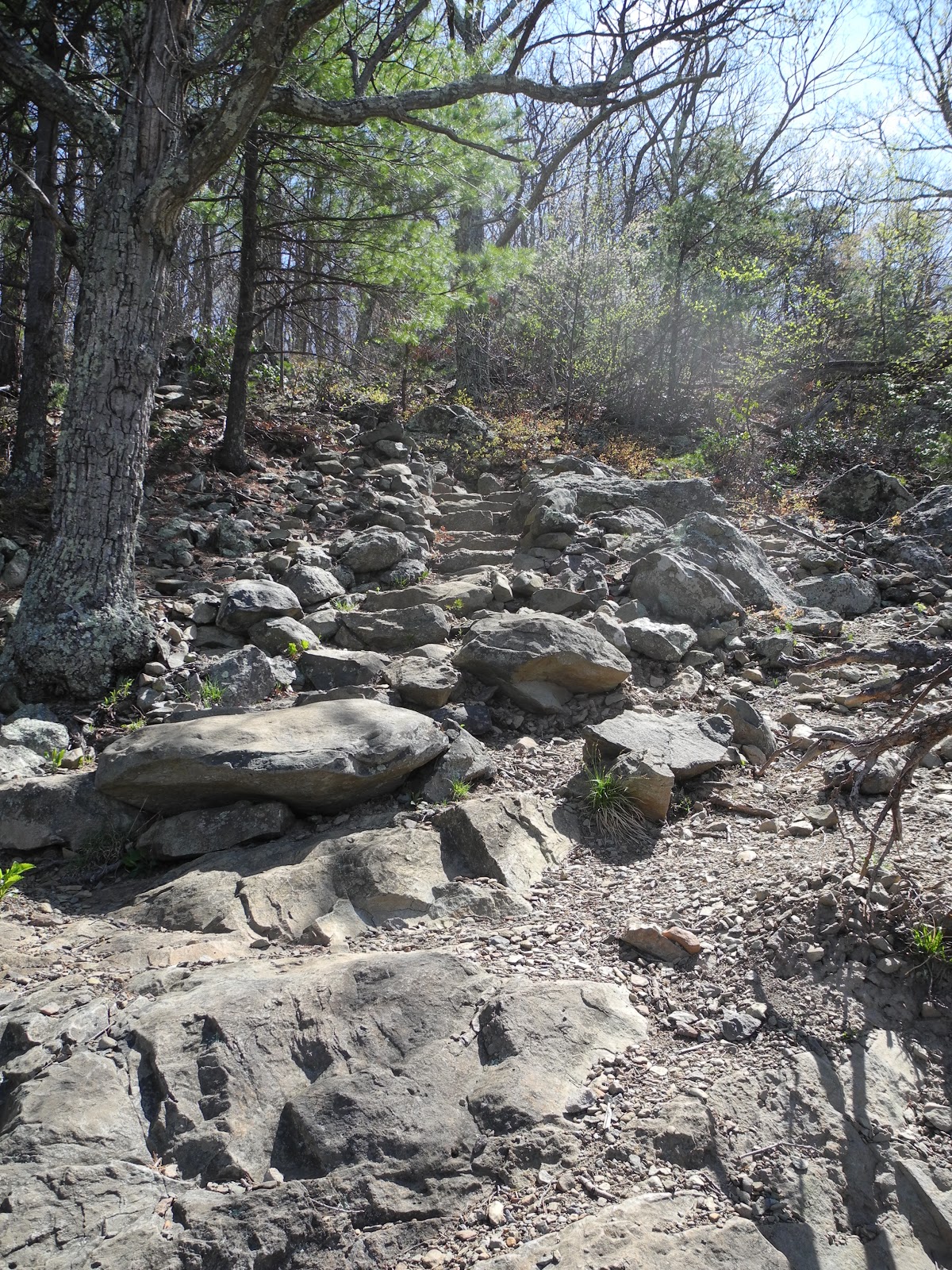 |
| Great rock work near Overall Run falls |
After emerging from the Overall Run canyon, I sat down for lunch at the junction with the Mathews Arm Trail. In the 2009 AT Guide to the Shenandoah National Park it says the Mathews Arm trail extends for 3 miles beyond the Tuscarora Trail but has obviously be taken out of use. On the back of the 2009 north section map the Mathews Arm trail is said to be just 1.4 miles. Mystery solved and 3 miles of trail I no longer need to hike!
After a quick lunch I decided to hoof it down the Beecher Ridge Trail. I'm not sure why I thought I didn't have enough time to take the Tuscarora the last 2.3 miles to the AT. As it was I finished by 3:30 and could easily have worked in an extra 4.6 miles (note: there is a lot of inconsistency between the book and the cement markers on the trail). At any rate, I hiked a half mile along the Mathews Arm trail and the Beecher Ridge Trail, which was unchanged from January 6 when I last hiked it I took a picture from my old lunch spot for comparison:

I continued on the Beecher Overall Connector and the Overall Run Trail. Neat huge rocks on the latter.
 |
| Lower Overall Run crossing |
 |
| Huge rocks off Overall Run Trail |
Total miles for day: 13.9
New trails: 3
New trail miles: 10.6 (I've passed the 100 mile mark!)
As a percent of total miles including the AT: 21%


No comments:
Post a Comment