Total Pageviews

Wednesday, January 25, 2012

SNAP 500 thermometers to measure progress


Vigorous hikers or banshee hikers?

Well THAT was a big day of hiking!  Yesterday, Jan. 24, I hiked with the PATC Vigorous Hikers in the Pinnacle Ridge area in the Central Section of Shenandoah Park.  We parked in Nethers at the Old Rag parking lot.  Although we had driven to the trailhead in pea soup fog, warm sunny weather developed during the morning.  We had many stream crossings along the way and some feared wet or icy rocks might cause problems in crossing the Hughes River near the beginning of the trail but the stepping stones were dry.  On the way up the hollow we saw many abandoned stone walls and home foundations.  It must have been really hard when the National Park came in and displaced homesteaders. 

Old homestead along Hannah Run Trail


As we walked up the Hannah Run Trail the weather warmed enough for me to strip down to a teeshirt and put on a bandanna to keep the sweat out of my glasses.

Crossing upper Hannah River


The group had subdivided in two bands of hikers quite soon after we started.  I was the caboose on the slower group.  After much huffing and puffing, we reached Pinnacles Overlook.  It turned out to be a splendid day and there was virtually no snow on the ridge.  A brisk wind, however, made us bundle up for the ridge section of the walk. 

Sign at Pinnacles Overlook

At the Pinnacles Overlook I just caught sight of the super vigorous hikers before they trotted away down Skyline Drive.  We slower vigorous hikers then walked (no rest stop for me) down the deserted Skyline Drive to the Jewell Hollow Overlook, where we picked up the A.T. for a mile or so, then crossed over the Skyline Drive to take the Corbin Cabin Cutoff down to PATC's Corbin Cabin where we ate lunch (my first chance to sit down since we started).  We just caught up to the fast group for a photo (below) before they took flight again.

The Banshee Hikers and the Vigorous Hikers overlap (momentary)
 
After a quick lunch, during which Phil caught up to us (we had inadvertently taken off from the parking lot without knowing he was part of the group), we climbed the Indian Run Trail to the Corbin Mountain Trail, which we took back to the Hannah Run Trail and the cars.  The Corbin Mountain Trail had a long section that was heavenly -- rock free gently sloping trail in the sun.

In the summer the Hughes River offers lots of opportunities for taking a dip.  Ken, the hike leader, warned me that the water wasn't much warmer in the summer than it is now.  

By the time we returned to the car we had walked 18 miles in 7 1/2 hours.  I had thought I was a "vigorous" hiker but that pace was just a tad too vigorous be comforatable for me.  Maybe I just need to get in better shape.  That fast group, however, completed their hike at a 3+ MPH pace.  Perhaps they should call themsleves the "banshee hikers" rather than just "vigorous".

I noticed one inconsistency in mileage. On the 2003 PATC map and in the 2009 guidebook it says the Indian Run Trail is 1.4 miles.  On the SNP trail post it says 1.7 miles.  Who is right? 

PATC vigorous hikers have outings every Tuesday and carpool from a commuter parking lot in Centreville, VA.  Check out the PATC website (PATC.net) if you're interested in joining them.

Final tally:  3 new complete trails (Hannah Run, Corbin Cabin Cutoff, Indian Run) and all but 0.6 miles of the Corbin Mt. Trail .

Total 19.7 miles and  10 sidetrails in the first 4 weeks of 2012.  That's 5% of sidetrail miles and 6% of sidetrails.  Got to up my weekly mileage if I'm going to make the 2012 SNAP 500!

Tuesday, January 17, 2012

SNAP 500 trails

In Google Docs I have uploaded the list of SNAP500 trails, excluding the Appalachian Trail.  It's called snap500 trails, oddly enough.  It is subject to change as PATC updates its maps and guidebooks. 

One new trail

We rented a PATC cabin for Sunday and Monday nights.  The Vining Cabin is tucked up in a scenic hollow above Stanardsville, VA.  It has electricity, heat, running water, and wood stoves.  The heat took a LONG time to warm the house up (about 24 hours in fact).  To reach the cabin, you need to drive up a long unpaved road, ford a stream, and then, after parking, schlep your stuff 0.4 miles up to the cabin.  We had intended to stay for two nights.  Having gotten there in the middle of the afternoon on Sunday, we had time to explore the property.  I took off up a trail toward the other cabins in the Vining Tract/Mutton Hollow area.  This trail was straight up and I didn't even reach the first cabin due to fading light.

On Monday I had planned to do a nice long hike in the southern section of the the park but when we got to Swift Run Gap we found that Skyline Drive was closed.  So I parked at the AT crossing and hiked up to and around the Saddleback Mountain Trail.  It was a crisp clear day and perfect for hiking.  I tried putting into practice what I had learned in photography class the prior week and thought I did  pretty well.  Unfortunately, due to low battery, none of the photos were saved.  Although I had hoped to add on the South River Falls Trail and South River Fire Road, I decided that I needed to get back and abandon ship at the cabin.  In the car on the way up I heard that the forecast was for rain starting at midnight and continuing through morning.  I didn't want to have to ford the stream in high water the following morning (nor hike in the rain).  So I turned around.

On the way back to Swift Run Gap I saw three large groups of college-aged kids and a large family group.  It's terrific to see younger people in the woods enjoying themselves. 

I learned several lessons on this trip.  First, call ahead to make sure Skyline Drive is open.  Second, compile a list of itineraries accessible from public roads outside the park.  Third, recharge your camera battery, dummy!  All of these would qualify as meeting the first rule of "Leave No Trace":  prepare and plan ahead. 

I have created a database with all the "trails" in Shenandoah National Park.   According the the SNP Appalachian Trail Guide (published by PATC) and the three PATC maps there are 162 sidetrails plus the A.T. in the Park.  Sidetrails total 392.7 miles within the Park Boundaries plus 103.4 miles of the Appalachian Trail within SNP boundaries.  Except for the Rapidan Wildlife Management Area in the Central District and the AT park property in the Southern Section, I intend to stay within the boundaries of SNP. 

So far I've completed 15.4 miles and 8 sidetrails. 

Tuesday, January 10, 2012

No hike today.  Because of the very wet snow/ice storm yesterday Skyline Drive is closed and I'll bet there's lots of ice on the upper reaches of the trails.  I don't mind snow but ice scares me especially if I'm hiking alone.  It's supposed to reach 50 today but I'd guess the trails won't melt until the afternoon. 

So I thought I'd put in a post about footwear.  Once upon a time, when I hiked most weekends in the White Mountains, I bought myself a pair of Limmers boots.  At the time they cost the exhorbitant price of $75 and required a year of waiting time.  I wore them all the time and eventually ordered a second pair because I didn't want to have to wait for replacement boots.  Over the years, however, I didn't take care of them and they got leaky.  I should have maintained them but I didn't.  So I moved to commercial hiking boots.  I was very happy with some men's Lowa boots but then, just as I was preparing for my A.T. thru hike, my boots died and the style had disappeared.  After reading Ray Jardine's PCT book about ultralight backpacking, and after trying on dozens of boots in local outfitters, I decided to try trail runners for hiking.  I am now a confirmed trail runner backpacker.  They were great on my thru hike (I walked through 4 1/2 pairs of Salomon XA Comps) and I've continued to use them.  Recently I've had problems with my feet (I got orthotics in 2005, have a sometimes-painful bonespur on the outside of one foot, hammertoes, and achilles tendon pain).  So I really need to find comfortable hiking footwear.  Now that I'm planning to hike in winter, I feel I need some sort of waterproof boots that will work well for miles of snowshoeing or hiking.  My Sorel snow shoveling boots and fleece lined LL Bean boots won't cut it for the miles.  So now I'm thinking of reconditioning my Limmers to see if they still fit my feet. 

Stay tuned. 

Monday, January 9, 2012

This splendid stone wall, which extends a long way along the Heiskell Hollow Trail, was probably the boundary of someone's land before the Shenandoah National Park was created. 

Saturday, January 7, 2012

What a remarkable day for hiking yesterday!  January 6th and close to 60 degrees!  I chose to hike some trails from Mathews Arm Campground. Unfortunately the gate was closed so I parked at the parking lot across Skyline Drive and walked down the mile or so of entrance road to the actual campground and then beyond it to the start of the trail.  I started hiking dressed in T-shirt, long sleeve t-shirt, rain jacket (as an all purpose jacket) and mittens but ultimately ended up hiking in my t-shirt because it was so warm.  The Heiskell Hollow trail goes downhill gently over lots of loose rocks then flattens out and runs alongside Compton Run (or Dry Run according to the PATC SNP trail guide).  From the hillside I could see views west -- this is one of the perks of winter hiking.  The Heiskell Hollow trail is essential a vestigial forest road.  The PATC map  indicates "falls" on the stream that comes in from the south but I'd say the stream tumbled down over rocks.  There were plenty of spots in the stream where someone could cool off in summer ... not swimming holes, just pools where maybe you could lie down and get wet.  I went as far as the Park boundary then turned around and came back to the Beecher Ridge Trail junction.  I don't know where Heiskell Hollow got its name.  Perhaps the Heiskells from further north (around Winchester, VA) settled here. Adam Heiskell fought in the Revolutionary War!

Although I had intended to hike over to the Beecher Ridge/Overall Run Connector junction and back, the trail went uphill so much that I decided to stick with the Beecher Ridge Trail.  The first section from Heiskell Hollow Tr. to the Connector Tr. seemed little used.  It passed through some nice open pine slopes with good views to the west.  Soon after the junction, I stopped on a low rock  for lunch along the Beecher Ridge Trail.  The sun was warm on my back and I had peekaboo views out toward Massanutten.  The trail reminded me very much of the Appalachian Trail. 

After ascending the rest of the way up the Beecher Ridge Trail, which is steep in places, I turned right on the Mathews Arm trail, then, after 1/2 mile, turned right onto the Weddlewood Trail.  What and odd name!  I tried to find out where the name came from but all I can surmise is that the name Weddle has some roots in Warren and Shenandoah Counties Virginia.  That trail continued on a gentle downslope back to the top of the Heiskell Hollow Trail, which I then followed back to my starting point.

It was about 2:40 when I got back to Mathews Arm Campground so I decided to walk the Traces Nature Trail which forms a beltway around the campground.  What a lovely trail!  No educational signs or numbers, so I wonder why they call it a nature trail.  It would be a splendid hike for a family staying in the campground.  Has just the right amount of challenge (uphill) and distance for young children.  Plus a water feature!  On the far side of the circle, there was some great trail work around a boggy area and a small stream crossing under the trail.  .

When I finished that I hustled back to my car because we had been invited out to dinner and a show.  In Front Royal I got gas, changed my clothes in the bathroom, and headed off to DC for dinner.  

Tally for today:  total miles hiked 12.7 of trails plus perhaps 3 miles of road.  4 trails completed.

Total to date:  6 trails completed (12.1 miles), 19.7 miles hiked 

Photos to follow (as soon as my desk top decides to connect to the internet).


Wednesday, January 4, 2012

Sunday, January 1, 2012

Jan. 1: 2 sidetrail miles, 2 complete trails

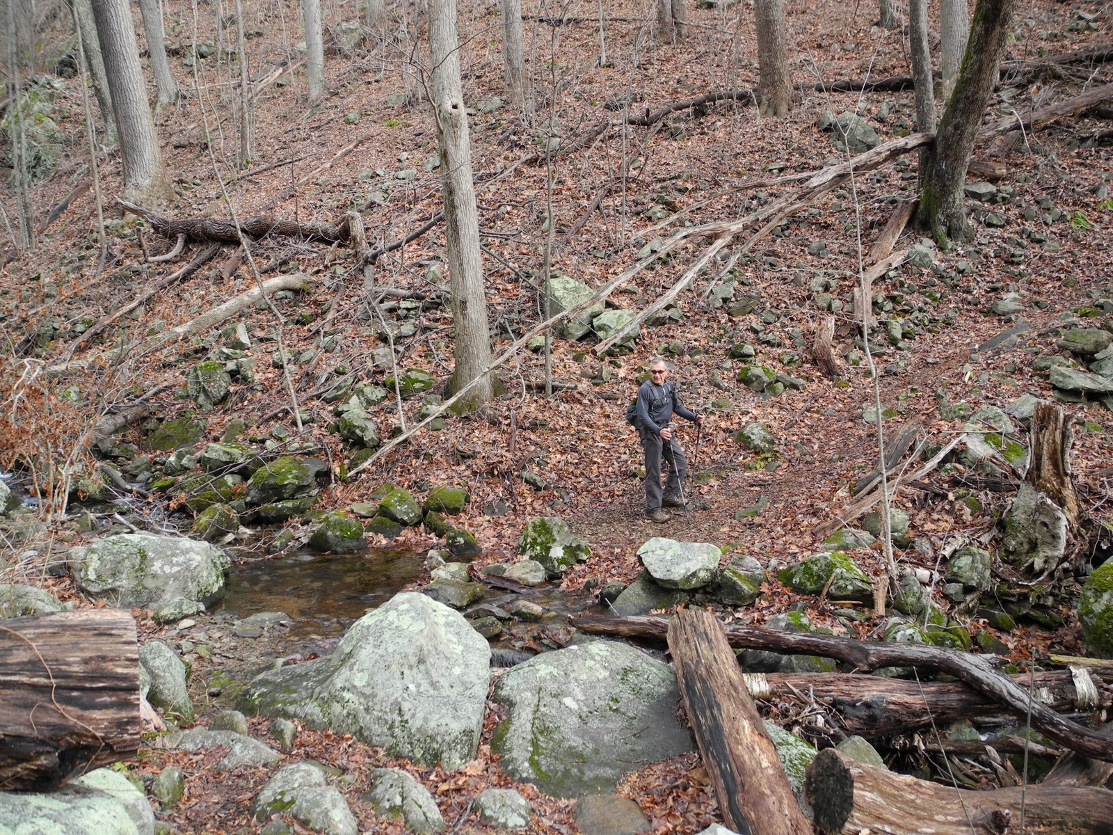
First few miles of the SNAP 500. Since today is the first day of 2012 Artunus and I knocked off a few miles in the Shenandoahs. It was a clear crisp day with a stiff wind. We started at Crescent Rock Overlook. CHEAP THRILL: Betty's Rock. Although not described in the PATC guidebook on the Shenandoahs, Betty's Rock (which is a 600 yard (0.3 mi) walk from the overlook) is well worth the short trip. Fabulous western views, well graded gravel trail.

From there we went to Hawksbill Gap and hiked up the Lower Hawksbill Trail to Byrds Nest 2 and the wide open summit. Two older folks tried to talk us out of taking the steep way up (thinking we didn't know what we were doing) but we prefer steep up and gentle down.

Up at Byrds Nest 2 there were 8 or 9 overnight campers in the shelter, right next to the sign that says "no overnight camping." Oh well. The views to the west from the front of the shelter and the 360 degree views from the top were fabulous. We were in the sun and had put on hats, wind jackets and mittens, so it wasn't too chilly.

Because of the wind, we decided to wait to eat lunch at the Rock Spring Hut. So we descended on the Salamander Trail, a pleasant well graded trail, jogged south on the A.T. for 0.4 miles, and took the cutoff to the Rock Spring Cabin and Hut. People were occupying the Cabin so we couldn't get a good look inside, but it looked lovely from a short distance away. A "porch" with open views to the west and (apparently) a fireplace burning away merrily. What a great place to spend New Year's Eve!

A trail maintainer was at the hut with his dog. We also met him later in the parking lot picking up litter. Thanks to him, the local A.T. and the Lower Hawksbill Trail are in tiptop condition.

After he headed off, we ate lunch, retreating to the hut overhang when the light spitting drizzle started.

After lunch, we went back to the car. Great waterfalls of ice and beautiful fern/moss displays greeted us on the A.T. back to the parking lot. I picked up a discarded Kleenex and a hiking pole basket on the trail. The trail maintainer had a trash bag, so I could off load my cargo with him.

We left Hawksbill Parking Lot at around 2 PM, thinking we'd like to do another short hike, possibly taking in another PATC Cabin. We parked at Hogback parking lot and ascended to the radio tower but that wasn't the viewpoint I remembered from my thru hike. As we descended the rain started. Feh. Raced back to the car and headed home around 3 pm.

But the Shenandoahs had one more treat in store for us: a momma bear and three cubs were rooting around in the woods off the Skyline Drive, just north of Compton Gap. We might not have noticed them except for the traffic jam.

It poured all the way home.

Mileage: 0.6 miles on the Betty's Rock Trail; 1.0 mile Lower Hawksbill Trail (according to the post), 0.7 miles on the Salamander Trail, and 1.8 miles (or maybe 2.0 depending on which source you use)on the A.T., plus 0.2 miles along side trail to the Rock Spring Hut.