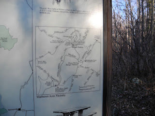
What a remarkable day for hiking yesterday! January 6th and close to 60 degrees! I chose to hike some trails from Mathews Arm Campground. Unfortunately the gate was closed so I parked at the parking lot across Skyline Drive and walked down the mile or so of entrance road to the actual campground and then beyond it to the start of the trail. I started hiking dressed in T-shirt, long sleeve t-shirt, rain jacket (as an all purpose jacket) and mittens but ultimately ended up hiking in my t-shirt because it was so warm. The Heiskell Hollow trail goes downhill gently over lots of loose rocks
then flattens out and runs alongside Compton Run (or Dry Run according to the PATC SNP trail guide). From the hillside I could see views west -- this is one of the perks of winter hiking. The Heiskell Hollow trail is essential a vestigial forest road. The PATC map indicates "falls" on the stream that comes in from the south but I'd say the stream tumbled down over rocks. There were plenty of spots in the stream where someone could cool off in summer ... not swimming holes, just pools where maybe you could lie down and get wet. I went as far as the Park boundary then turned around and came back to the Beecher Ridge Trail junction. I don't know where Heiskell Hollow got its name. Perhaps the Heiskells from further north (around Winchester, VA) settled here. Adam Heiskell fought in the Revolutionary War!
Although I had intended to hike over to the Beecher Ridge/Overall Run Connector junction and back, the trail went uphill so much that I decided to stick with the Beecher Ridge Trail. The first section from Heiskell Hollow Tr. to the Connector Tr. seemed little used. It passed through some nice open pine slopes with good views to the west. Soon after the junction, I stopped on a low rock for lunch along the Beecher Ridge Trail. The sun was warm on my back and I had peekaboo views out toward Massanutten. The trail reminded me very much of the Appalachian Trail.
After ascending the rest of the way up the Beecher Ridge Trail, which is steep in places, I turned right on the Mathews Arm trail, then, after 1/2 mile, turned right onto the Weddlewood Trail. What and odd name! I tried to find out where the name came from but all I can surmise is that the name Weddle has some roots in Warren and Shenandoah Counties Virginia. That trail continued on a gentle downslope back to the top of the Heiskell Hollow Trail, which I then followed back to my starting point.
It was about 2:40 when I got back to Mathews Arm Campground so I decided to walk the Traces Nature Trail which forms a beltway around the campground. What a lovely trail! No educational signs or numbers, so I wonder why they call it a nature trail. It would be a splendid hike for a family staying in the campground. Has just the right amount of challenge (uphill) and distance for young children. Plus a water feature! On the far side of the circle, there was some great trail work around a boggy area and a small stream crossing under the trail. .
When I finished that I hustled back to my car because we had been invited out to dinner and a show. In Front Royal I got gas, changed my clothes in the bathroom, and headed off to DC for dinner.
Tally for today: total miles hiked 12.7 of trails plus perhaps 3 miles of road. 4 trails completed.
Total to date: 6 trails completed (12.1 miles), 19.7 miles hiked
Photos to follow (as soon as my desk top decides to connect to the internet).


No comments:
Post a Comment